
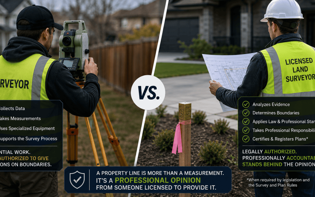
The words “surveyor” and “land surveyor” are often used interchangeably, but in British Columbia there is an important distinction.
Many skilled people work in surveying. Survey technicians and other survey professionals collect data, operate sophisticated equipment, search for survey monuments, perform calculations, and carry out much of the fieldwork you may see on your property.
But when someone tells you:
“This is your property line.”
there is another question you should be asking:
Who is professionally authorized and responsible for that boundary determination?
It’s Not Just About Measuring Accurately
Modern survey equipment can measure positions with remarkable accuracy. An experienced surveyor or technician may also have considerable knowledge of survey plans and boundary evidence.
But determining a property boundary involves more than taking measurements.
A practising British Columbia Land Surveyor (BCLS) is a licensed and regulated professional with the education, training, and professional authority to determine and provide advice on boundaries and interests in land.
The Association of British Columbia Land Surveyors (ABCLS) regulates the profession. Practising land surveyors are subject to professional and ethical standards and are required to maintain professional liability insurance.
This means that when a BCLS determines a property boundary, there is a regulated professional who stands behind that determination and accepts responsibility for it.
That is the key difference.
How Is a Property Boundary Determined?
A property boundary cannot always be recreated by simply taking the dimensions shown on an old plan and measuring them on the ground.
A BCLS may need to consider:
- existing survey monuments;
- registered and historical survey plans;
- Land Title or Crown land records;
- measurements from the property and surrounding parcels;
- occupation and improvements on the ground;
- applicable legislation and regulations; and
- the ABCLS Survey and Plan Rules.
Sometimes the evidence agrees. Sometimes it doesn’t.
A fence may not be on the property line. A monument may be missing. An older survey may not perfectly agree with modern measurements.
A practising BCLS reviews the available evidence, applies the appropriate legal and surveying principles, determines where the boundary is, and takes professional responsibility for that determination.
What About Survey Technicians?
Survey technicians are an essential part of professional land surveying.
A technician may operate the survey equipment, search for monuments, collect measurements, perform calculations, and even physically place the stake marking a property boundary.
There is nothing wrong with that.
The important question is who is professionally responsible for the boundary represented by that stake.
There is a significant difference between a technician placing a stake as part of a survey being completed under the professional responsibility of a BCLS and an unlicensed individual independently deciding where a boundary is located and presenting it to a property owner as their property line.
The stake may look exactly the same. The professional responsibility behind it is not.
Why Does Professional Responsibility Matter?
Consider two people who independently inspect the same property and point to exactly the same location for the property line.
One is an experienced but unlicensed surveyor acting independently.
The other is a practising BCLS who has reviewed the evidence and made a professional boundary determination.
They might reach the same conclusion, but the two opinions do not have the same professional standing.
The question isn’t simply whether someone arrived at the correct measurement. It is whether that person is professionally authorized to make the determination and take responsibility for it.
This becomes particularly important when the survey is relied upon for a fence, building setback, development, subdivision, property transaction, or boundary dispute.
It also matters when a survey needs to become a formal plan. A BCLS can certify survey work and, where applicable, prepare and certify statutory survey plans for filing in the Land Title Register or Crown Land Registry in accordance with applicable legislation and the ABCLS Survey and Plan Rules.
Be Careful About Unauthorized Practice
The ABCLS cautions the public about obtaining land surveying services from unlicensed and unregulated providers. These services may be unregulated and potentially uninsured.
This does not mean that every person performing fieldwork must personally be a BCLS.
Instead, when the work involves determining your property boundary, you should know which practising BCLS is professionally responsible for the survey.
The ABCLS maintains a Public Register where you can verify the professional status of a land surveyor.
If someone is independently offering to determine or mark your property boundary, two simple questions can help:
“Are you a practising British Columbia Land Surveyor?”
or, if a technician is completing the fieldwork:
“Which BCLS is professionally responsible for this survey?”
The Bottom Line
There are many highly skilled people working in surveying, and survey technicians play an important role in professional land surveying.
But being able to measure a property boundary is not the same as being professionally authorized to determine it.
When you are relying on the location of a property line, make sure there is a practising British Columbia Land Surveyor professionally responsible for that determination.
The important question isn’t just, “Where is my property line?”
It is, “Who professionally stands behind that answer?”
If you’re unsure about your property boundary or what type of survey you need, Elevate Land Surveying can help determine the appropriate next step.
We have an unique office model where our land surveyors pick up all client calls.
-
Helpful ABCLS Resources